Cowles MountainCity: San Diego
Distance: 3 miles (round trip)
Distance: 3 miles (round trip)
 (source: Kevin O’Connor/flickr)
This a very popular trail that can get crowded at times, but it’s an easy hike with a well-maintained trail that has a lot of switchbacks and when you get to the top, a gorgeous panoramic view of San Diego that includes Downtown and Mexico on a clear day.
Torrey Pines State ParkCity: La Jolla
Distance: 5.6 miles
Distance: 5.6 miles
![tpp_021005-2[1]](http://fyeahcalifornia.com/wp-content/uploads/2014/10/tpp_021005-21.jpg)
This is a hike with beautiful ocean views. Once you find parking along the beach or pay 10$ to park in the parking lot, you walk up Torrey Pines Road and from there you have multiple trails to choose from, like the Guy Fleming Trail or The Razor Point trail. You can expect an easy to moderate hike with amazing views as all the trails come to edges of cliffs overlooking the crashing waves of the ocean below.
Mount San MiguelCity: Chula Vista
Distance: 4.6 miles
Distance: 4.6 miles
![600_286493302[1]](http://fyeahcalifornia.com/wp-content/uploads/2014/10/600_2864933021.jpeg)
Don’t let the short distance fool you. This trail is steep and very challenging. Mt. San Miguel is one of the least hiked trails in the San Diego area. On an average day, you’ll probably see at most 1-3 other hikers. The trail goes straight up with no switchbacks so be prepared for a workout. When you get to the top, you’ll have an amazing view of Sweetwater Reservoir and Downtown San Diego to the west, and Otay Lake and Mexico to the South.
There’s a more moderate hike nearby on Mother Miguel Mountain. It’s not as high as Mt. San Miguel but you still get the great views of San Diego and Chula Vista.
Iron Mountain
City: Poway
Distance: 5.8 miles
City: Poway
Distance: 5.8 miles

A good solid hike, the Iron Mountain trail is not too steep and difficult but it has great scenery with well-maintained trails. This is a satisfying hike if you want to get out of the city and experience great views of central San Diego county.
Mount WoodsonCity: Poway
Distance: 6.4 miles
Distance: 6.4 miles
![Oh5N4SZ[1]](http://fyeahcalifornia.com/wp-content/uploads/2014/10/Oh5N4SZ1.jpg)
The trail at Mt. Woodson is long and has sections that are steep, so be prepared for a moderate to strenuous hike. At the peak, you’ll get views of the ocean and Palomar to the east. One of the unique landmarks on this trail is the famous Potato Chip Rock, which is the long,thin slice of rock that has become a popular photo-op for trail visitors.
Los Penasquitos Canyon Preserve
City: San Diego
Distance: 4.7 miles
City: San Diego
Distance: 4.7 miles

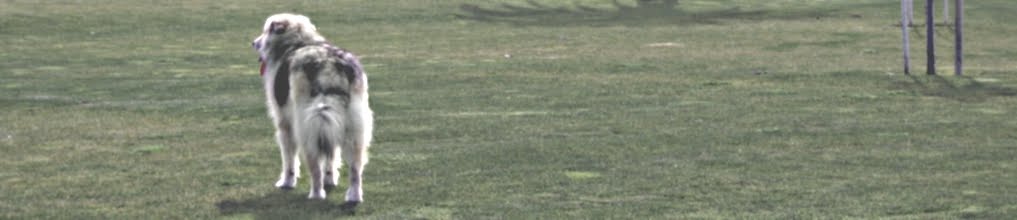
Mostly flat and with views of interesting scenery including waterfalls and streams, the trails at Los Penasquitos Canyon Preserve are great for a leisurely stroll with kids or dogs.
Cedar Creek FallsCity: Ramona
Distance: 4.5 miles
Distance: 4.5 miles

The waterfall and natural pool at the end of the trail is what draws many visitors to Cedar Creek Falls but it is one of the most dangerous trails in the county. Temperatures can get extremely hot and hikers can suffer heat stroke if they don’t bring enough water. Calls for rescue are common because inexperienced hikers underestimate how extreme the conditions can get. At the falls, people have died slipping off the cliffs and hitting the rocks below. To limit the number of visitors, a permit is required: $6 for every 5 people.
Three Sisters Falls
City: Julian
Distance: 4 miles
City: Julian
Distance: 4 miles
 (source: SummitPost)
Like Cedar Creek Falls, this destination has a waterfall and is not for beginners. You’ll have to be prepared for steep inclines/declines, rock/boulder climbing, and sun exposure. Bring plenty of water and leave the pets at home. You might be disappointed by a dried up pool in the summer months but the trail to the falls is a great challenging and satisfying desert hike nonetheless.
Cuyamaca Rancho State Park
City: Descanso
Distance: more than 100 miles of trails
City: Descanso
Distance: more than 100 miles of trails
 (source: SummitPost)
Cuyamaca Rancho State Park has a ton of trails for hikers to choose from with areas of woodlands, meadows, and waterfalls. One of the popular trails is the 6.7 r/t trail to Cuyamaca Peak (second highest peak in San Diego County) which rewards hikers with amazing views of Cleveland National Forest and Cuyamaca Rancho State Park.
Stonewall PeakCity: Descanso
Distance: 4 miles
Distance: 4 miles
 (source: Chris Ten Eyck/flickr)
This hike is a fairly easy, moderate hike in the Cuyamaca area with a well-maintained trail and plenty of trees providing shade along the way. At the peak is a spectacular view of Cuyamaca with the Palomar Observatory to the north, the Salton Sea to the east, and on a clear day, the ocean to the west and Mexico to the south.
For more hiking trails around San Diego, check out these great hiking guides: